Code for this project can be found HERE
In British Columbia, car insurance is provided by a single crown corporation: Insurance Corporation of British Columbia (ICBC). As a result of being a crown corporation, they are beholden to open data policies within the province similar to a government agency. As such, a significant amount of data about the accidents that occur in the province is made available and can be found HERE
Much of the data can be broken down regionally in BC, or by municipality. Being a Vancouver resident, I am aware that there are a number of unique neighborhoods and communities, 22 in all, within Vancouver. Given the number of unique neighborhoods in Vancouver, I wanted to ask: are there any trends or insights that could be made about ICBC reported accidents at the neighborhood level in Vancouver?
This project is broken down into 3 parts:
- Wrangling and cleaning ICBC data to include Vancouver neighborhood information.
- Exploratory data analysis using MySQL
- Creating visualizations and dashboards using Tableau.
In preparation for analysis, I had to gather acquire the geo-location data for each neighborhood from the City of Vancouver and use the location data in the ICBC data to accurately label each accident with the neighborhood they occurred in. I used the Shapely library in order to make the shape of the neighborhood and determine whether an accident occurred within the shape.
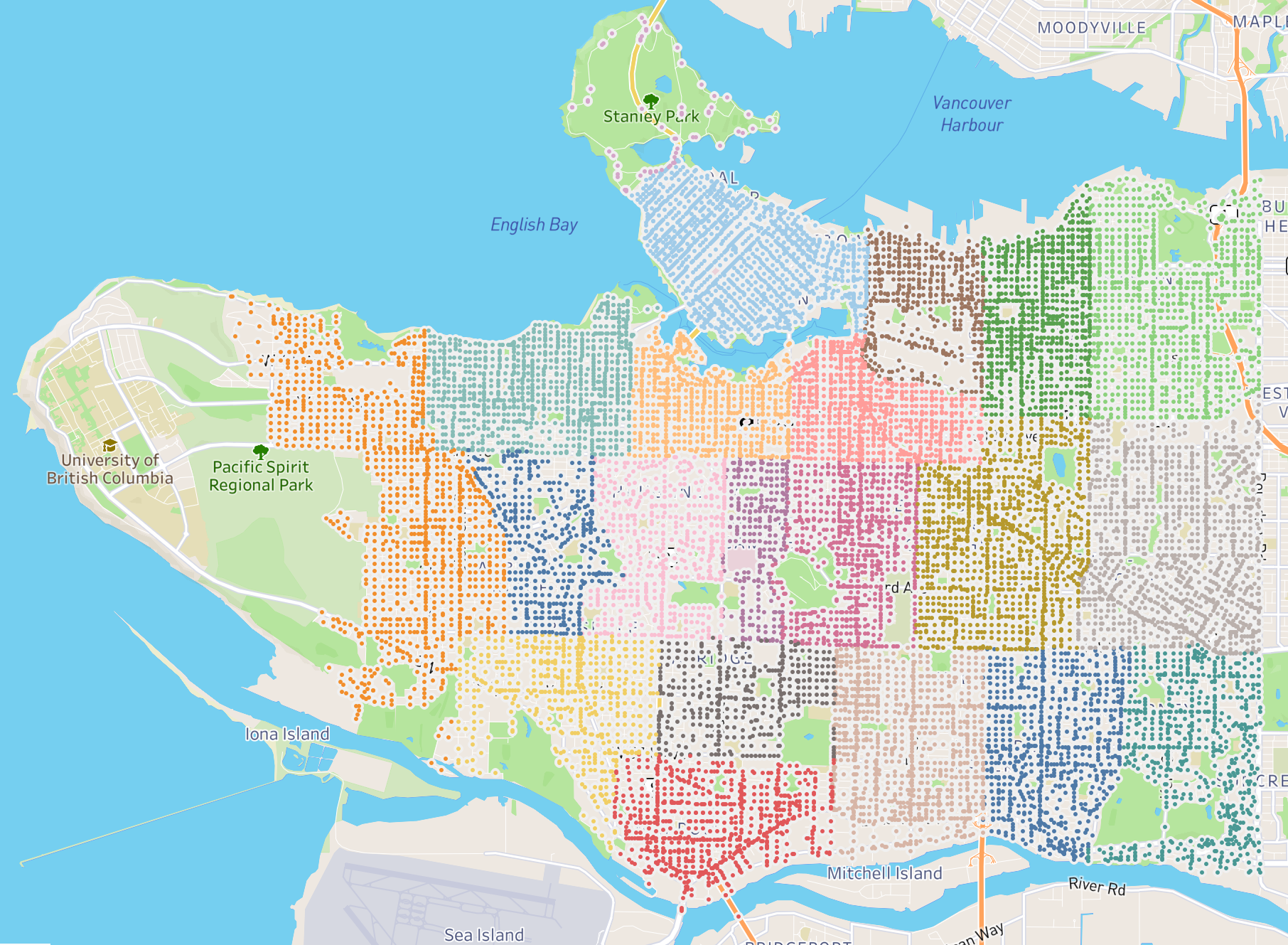
Once I completed the data wrangling, I had 213,085 accidents recorded in 23 neighborhoods, adding Stanley Park to the 22 existing neighborhoods in Vancouver. You can see a map of the Vancouver accident data below:

Part 2 of this project will explore the data using MySQL and identify some trends in the locations, times and descriptions of the data.